
Dani Weighs In

As I drove Conor home from school, the car’s GPS screen tracked our every move. Some people may feel spied on by global positioning devices, but the feeling I’m inside a map makes me feel safe.
The clear criss-cross of roads and curvy lanes makes me feel sure of myself. Instead of a messy-haired mom in sweatpants, I am a bright red arrow moving steadily in the right direction.
The map in my head is a bit like our car’s GPS, except my range is infinitely smaller. My little mental map allows me to drive anywhere in my well-defined radius: the kids’ schools, the grocery store, library, friends’ houses. From the top of my street, a left takes me to town and a right to the beltway.
And, really, where else could I possibly want to go?
I have never had an innate sense for which way is which, so a map, for me, is essential. The trick is getting it in the right position – holding it so I line up myself with the picture of the streets.
In fifth grade, Mrs. Hale had us stand beside our desks after a short lesson on the compass. “Everyone face north,” she’d say. Then, “East.” All my friends dutifully spun to face the same wall, almost bored with how easy it all was.
I was the one looking at the flag while the rest leaned to get a look out of the open classroom door, or admiring the diorama on the back wall while everyone else took in the view outside the windows.
Traveling, I happily yield to Craig, who calls himself “the human GPS.” He can emerge from a subway and instinctively know which way leads to the museum.
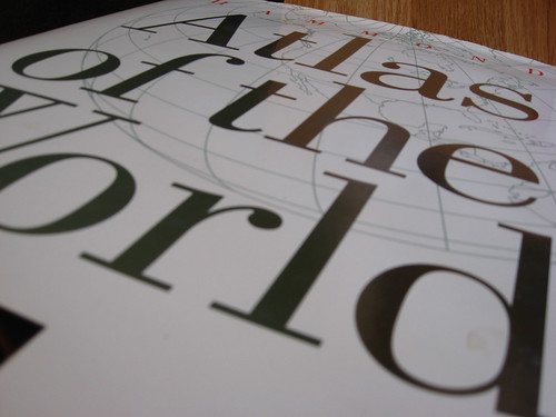
Though I’m bad at reading them, I love maps: Big hardcover atlas drawings of land veined with crooked routes and wrinkled by mountains and the pale blue water surrounding, dotted with impossibly small green islands; the laminated street map that highlights a city’s main attractions with snazzy contemporary graphics; the hard-to-refold, soft paper maps that spend years in the door of your car waiting for the another road trip through the Smokey Mountains.
With the right map you can find the lakeside park, the hotel, the town center, the treasure.
Sometimes, when driving along my memorized routes, I imagine the car’s silver roof. I’m looking down on it from above and seeing it decisively turning up and down streets. The narrow lanes make a grid connecting communities.
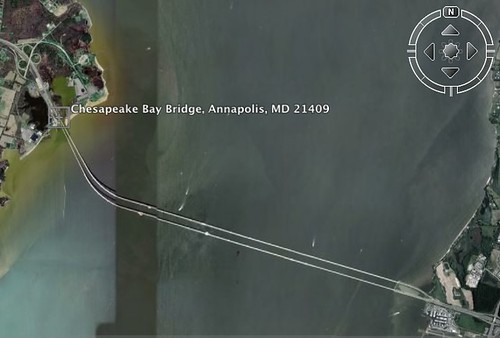
I can go as far as the Eastern Shore on my grid. From overhead I can see the awesome Chesapeake Bay Bridge. Toy cars in all colors move across the span. On the GPS screen, the red triangle symbolizing our car looks suspended in air over the vast water: the whole screen blue, with a little red arrow floating across.
With the world trip coming up, I will have to file away the well-known map that covers everything from my town to just past the Bay Bridge and practice making sense of maps for towns I never even knew existed.
The map in my mind will grow with creaks and groans. I may face the back wall by accident, but I know my map-ish husband will take me by the hand and guide me in the right direction.
Can you see us from above? Four explorers finding new paths.


4 comments
Dani, I can hear you now.
Nice to hear from you Dani! I just wanted to congratulate all of you on this courageous choice and beautiful website. I am always excited to hear about another family hitting the RTW road! I never used a gps before our trip started 19 months ago, but I have become totally in love with ours now. You will be surprised how quickly you will get familiar with new areas and how they will quickly become your home away from home. Even getting lost sometimes makes for a great shared story and good laugh later. Hope we can meet on the road some where along the way!! Carpe Diem….you are going to love this!!
hey dani,
I also find myself “map-challenged” and often relinquish the duties to our 11 y.o. who has a fascination with them. i find myself even a little panicked if i’m in a car without one. what’s up with that? i only started using one 2 years ago and how do i find myself so dependent on it now. when asking directions, i simply ask for the address… and when they start to give me landmarks and directions, i say, it’s ok, i’ll just punch the address into the car. i definitely need to get more secure with maps before we begin our journey as well. excited for you guys and your adventure….our kids are the same age – maybe we’ll end up in the same country at some point.
peace,
b
Buffy, Let’s definitely plan to cross paths at some point. It’s fun to planning this while you guys are, too! Thanks for your note! (I enjoy your blog and your great psychedelic family photo.)